

![]()
GIS DECISION MODEL
How It Works
A brief description of the GIS Risk Model methodology.
<Include Alisa's Diagram>
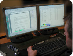
Data Visualization for Concensus Building
 The MPDESS is a geographic information system (GIS) assisted management tool. A Geographic Information System (GIS) is a computer program used to collect, edit, analyze, store, and distribute spatial data. A GIS maps features as points (such as boat locations, manatee sightings, or signs); lines (including channels, and trip routes); and areas (such as seagrass beds). Most importantly, the GIS captures and preserves relationships between the mapped positions and characteristics or attributes of those features (for instance, the draft of a vessel or activity associated with a trip).
A GIS displays various kinds of data as separate layers on a computer monitor. It also can show tabular information about features selected either spatially on the map or by specifying attribute values. Examples include distribution of use according to boat draft, or activities conducted. The GIS facilitates data queries and analysis to answer unforeseen questions as they arise. The MPDESS contains relevant GIS data themes and information modules that integrate with educational components to present the management, legal, and regulatory framework, explain the decision process, and outline the implications of alternate management scenarios. For the MPDESS, specialized GIS functionality combines spatial data layers that are important to the manatee protection decision process to identify locales where risk to manatees is lower or greater.
Program Elements
<Describe the GIS multi-overlay criteria and method/algorithm for assessing risk.>
- Spatial Filter for Mapping Manatee Occurrence
- Composite Scoring Scheme/Algorithm