
![]()
Introduction
MPDESS - A GIS Analysis Tool for Balancing Coastal Resource Use and Manatee Protection
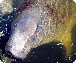 A particularly contentious management issue in the state of Florida involves balancing protection of the Florida manatee (Trichechus manatus latirostris) with public access to, and use of, coastal waters. Public debate surrounding the issue is acrimonious, often pitting environmental interests against those of boating and fishing. The polarization of public debate makes it increasingly important to standardize and clarify the process by which manatee protection zones, a type of marine protected area, are classified and demarcated throughout Florida waters.
The challenge to users, resource managers, elected officials, and planners is how to sustain and protect manatees without isolating people from the waterways. Can we continue to use coastal waters and protect manatees as needed to maintain the economic vitality of coastal communities for generations to come? Resource managers, policy makers, and the public need a clear vision of the decision process and the information considered when developing protection measures. Solving this problem will require science-based information and effective tools. This website describes one such tool, a Manatee Protection Decision and Education Support System (MPDESS) developed to foster public and agency concensus building regarding manatee protection.
The MPDESS adds functionality to the ArcGIS geographic information system (ESRI) and provides stakeholders with an interactive visualization tool to view, query, synthesize and interpret relevant spatial information—whether regarding manatees, habitat, or boats/boaters. The MPDESS:
- Helps planners and policymakers identify and prioritize human and environmental factors to evaluate risk to manatees.
- Employs a detailed, comparative analysis of environmental, physical, management, and human use conditions, relevant to manatee protection.
- Provides a comprehensive, regional overview of relevant conditions and the geographic distribution and severity of existing risk to manatees.
- Explains the decision process and
- Allows a science-based, objective approach to manatee protection efforts.
The goal the MPDESS is to engender a greater understanding and appreciation of this complex management issue. This may result in increased public acceptance of management measures designed to balance manatee protection and public access to Florida’s waterways.
Creation of the MPDESS was funded by the National Oceanographic Atmospheric Administration Coastal Service Center (NOAA CSC) and the Florida Fish and Wildlife Conservation Commission Fish and Wildlife Research Institute (FWC FWRI).